Saturday, December 27, 2014

100 Miles to Christmas - Part 2


This is the second part of a four-part trip report.  To start at the beginning, click here.

Day 4:
Personal Sunrise 7:59 am
Personal Sunset unknown (cloudy)

Today was an exciting day - a time to redeem our long term planning.  I'm speaking, of course, of collecting one of my food caches.  We hit the Thunder River trail, dropped our packs and headed up to the rim.  My cache hadn't been disturbed, other than a hole chewed through my note by a mouse.  Most importantly, the beers were still intact!  We walked back down the trail, and I had no pack and a beer in my hand.  This was the only moment during the hike that I really wanted to meet another backpacker out there, just to see the reaction.

Good thing the mouse read my note and left my food intact!  Or maybe he chewed through it out of frustration after being thwarted by the paint cans?

We returned to our packs and continued along the Esplanade, this time on the Thunder River trail.  Having a trail made the walking a lot easier; especially avoiding the Cryptobiotic soil that is so prevalent in this part of the Canyon.  Beautiful stuff.

This part of the Canyon is full of beautiful, delicate Cryptobiotic soil.

We made it to the edge of the Esplanade platform and started down the trail to Surprise Valley.  Surprise Valley was formed when a huge block of rock slide down into the Colorado River, turning as it went.  From the junction in the valley we turned left to head towards Thunder River, our site for the night.  I had never been there before, and I'm glad we got to include it in our route.  From the middle of a cliff (in the Muav Limestone), the water comes pouring out of the rock to form a waterfall, which cascades down the slopes below.  Absolutely beautiful.  It also has the dubious distinction of being a River which flows into a Creek, which flows into another River, which does not reach the Ocean.

Thunder River.
We camped at the Upper Tapeats Camp, just below the confluence of Thunder River and Tapeats Creek.  As impressive as the river is, it's not even the main source of the creek - Tapeats Cave, farther upstream, supplies an even stronger fountain of spring water.  The combined flow lulled us to sleep that night, until we were woken up by rain and had to bail into the tent.  57 miles to Christmas.
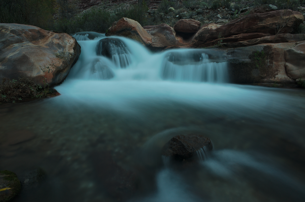
Tapeats Creek
Day 5:
Personal sunrise 2:06 pm
Personal sunset 4:20 pm

After a full night of rain, during which rats tunneled through Snickers bars in Craig's pack, we had a decision to make - continue up our original route, up Tapeats Creek and Saddle Canyon?  Bypass Tapeats above the Tonto but still do Saddle?  Or do the true backup plan, hike back up to the Esplanade and contour above the Supai around to Muav Saddle?  The first plan would go, but guarantee us getting soaked in the narrows of Tapeats Creek.  The second plan avoided that section, but Saddle Canyon would definitely still have some wading.  And the third definitely was possible, but we had no beta on it and were pretty sure it would involve some tough bushwacking.

We figured that we were well equipped to deal with snow, rain, or any other form of precipitation we were likely to deal with.  We also had an extra day's worth of food in case the route proved more difficult than anticipated.  And we are both very experienced with bushwacking.  Given the recent rain and the fact that every pool in Saddle Canyon was surely full to the brim, we decided to go for option 3 and head back up to the Esplanade that night.  First, however, we decided to take a side trip to Deer Creek.

The beginning of the Deer Creek narrows
Deer Creek is another stunning jewel of the desert, a gorgeous spring-fed slot canyon.  The trail takes you from Surprise Valley, past one of the sources of the creek, and then down creek to where the slot begins.  Once the canyon bottom drops away, the trail follows ledges in the upper part of the slot.

Careful . . .
After Deer Creek we headed back up above Surprise Valley to the top of the Supai to camp for the night.  At first, it looked like it was going to clear up for the night, and I was able to get one milky way shot in, but then the clouds moved in.  Which isn't always a bad thing after a rainy day, since cloud cover keeps the nights from being too cold.  The next night we wouldn't be so lucky.  53 miles to Christmas.


Day 6:
Personal sunrise 2:06 pm (again!)
Personal sunset 5:08 pm

Snow, sleet and sun alternated all day.  We were contouring on the Esplanade, but the sandstone quickly petered out and was replaced with bushwacking, of increasing intensity.  We were leaving the wide sandstone expanses of the western Grand Canyon and heading towards the land of heinous bushwacks - high drainages on the North Rim drainages.  The elevation of the Esplanade increased as we were heading up the Kaibab Upwarp, and the microclimate began to shift towards a wetter one that favored such plants as manzanita, scrub oak and cliff rose.  They are beautiful plants, and I'm particularly fond of manzanita.  But the abrupt shift from easy sandstone walking was a rough one.  We tried to take the path of least resistance, but by the end of the day our shoes were soaked from the snow and our shins were battered from pushing aside manzanita branches.  Craig even had a pocket ripped open and his knit hat ripped out.  For the rest of the trip, he would borrow either my fleece hat or my balaclava, whichever I wasn't using at the time.

A rare moment of easy walking.
Fighting our way through the brush, we headed the tributaries of the Tapeats Cave drainage, then headed down into Crazy Jug Canyon and out a tributary on the other side.  By the end of the day, we had our bushwhacking heads back on and were finding better paths through the brush, but it was still tough going.  The drainage crossings were the worst, filled with oaks and snow in the bottom and on the north-facing sides.  Our goal was to cross Timp Canyon and camp on the other side, to hopefully ensure that we would make it past Muav Saddle and down to lower elevations on our next night.  By the time we got to Timp it was after 4 pm, but the sun had come out and Timp turned out to be one
 of the easier drainages to cross, so we made it with time to enjoy the sun setting behind Mt. Trumbull.

The sun setting across Timp Canyon.

As we ate dinner, we noticed that the clouds had cleared up all over the sky.  It looked like a front might be moving in, clearing them away.  Good news for tomorrow, but bad news for tonight.  Without a thermal blanket above us, the earth radiated away its energy quickly, and the cold set in.  The clearest sign of this came from my sleeping bag, which had gotten slightly damp during the day.  While I was still eating dinner, a little before 6pm, that water was turning to frost!  We quickly moved every damp or loose item under or inside of a pack, "to prevent frosting".  Too bad we didn't have a cake.  44 miles to Christmas.

Day 7:
Personal sunrise 8:35 am
Personal sunset 3:18 pm


Sunrise from my sleeping bag

What a long day.  8 miles as the crow flies, much longer by our route.  We woke up to beautiful blue skies, a gorgeous sunrise, fog in the distance below Mt. Trumbull, and shoes frozen solid.  Thankfully the shoes thawed rather quickly once we started walking.  We had three major drainages to cross.  Stina Canyon was the biggest, and we contoured into it on a nice patch of Esplanade to plan our attack.  By now we had gotten better at this and were able to find a way down, a nearly brush-free crossing right above a pour-off, and then a scramble up the other side.  A little foresight goes a long way when you're battling oaks.

Sunrise a few minutes later

We continued up to Muav Saddle on the eastern slopes above Saddle Canyon.  The drainage crossings were full of scrub oak and the occasional new mexican locust, but most of the hiking was in juniper/manzanita country, with the occasional pinyon, agave or prickly pear.  I really enjoy this kind of bushwhacking - enough challenge to keep it interesting, but not enough to get frustrating.  And after the day before I was fully in the zone and prepared for it.  It puts one in a unique headspace; mind occupied simultaneously by your route on multiple scales.  You need to pay attention to your immediate steps: avoiding that prickly pair, for instance.  And you need to look ahead for paths of least resistance through the vegetation, connecting them to each other and forming hypothesis about what might lay ahead.  Finally, you have to make sure you're meeting your general goals of where you want to get to - contouring and maintaining elevation, heading up to a saddle, entering or leaving a drainage, etc.  With my mind occupied by all of these things, I feel fully present in the landscape. 

Manzanita.  'nough said.

As we ascended through the brush, we kept thinking we would drop into Saddle Canyon, but the slopes on the east side kept presenting us with better alternatives.  The junipers gradually gave way and we were walking through knee to waist high manzanita.  The day before this would have frustrated me, but with the right head on my shoulders I just slowed down slightly, gave the branches their due respect, and passed through the gauntlet relatively unscathed.  Working with and around the manzanita, rather than against it, makes a huge difference.  And it sure as hell beats fighting locusts up a drainage.

Finally, however, the good manzanita ran out and we dropped into Saddle Canyon just after Powell Spring.  The drainage was easier than we expected, with the occasional oak or locust to avoid, but no thickets.  And best of all, we were entering ponderosa pine country.  These were big, old-growth ponderosas, most of them at least 3 feet wide.  These old trees have a yellow-red bark and are called "yellow-bellies".  They also have an amazing smell to them, like butterscotch or vanilla.  I made sure to stop and put my nose in between the bark of the bigger ones.

Heading up the Saddle Canyon drainage in the snow

Up on Powell Plateau, just a short walk from Muav Saddle, lies an even larger grove of yellow-bellies.  Protected from logging by the relative difficulty of accessing them, they remained unscathed.  Up there, every tree is a yellow-belly, and when you top out on the plateau the entire place smells of butterscotch.  If there had been less snow on the ground we would've made the side trip up there, but we wanted to ensure that we camped down lower to have a warm night.

We got to the patrol cabin below Muav Saddle at 2pm.  This was used by Teddy Roosevelt back when he was hunting cougars on the Plateau, and now is used occasionally by backcountry rangers.  It contains a register, and as is my way when I encounter a register, I added a haiku:

Snow makes great TP
Forty miles to Christmas
There's beer at the Ranch

The PEAKS!

After reading and writing in the register, we headed up to the Saddle, and I could see the San Francisco Peaks!  It was great seeing a little slice of home.  This was the mental crux of our trek, and we had been dreading the snow for the previous couple of days.  It was also the halfway point, in terms of time.  So it was great to be over the hump and headed down.  This was our second scenic divide - we said our goodbyes to the Esplanade for good, and headed down the North Bass Trail.  Having a trail made a huge difference in our time, and we got all the way below the Redwall and out onto a campsite on the Tapeats sandstone before dark.  Craig had the quote of the day on the way down: "It's nice to be walking through the manzanita, without walking through the manzanita".

34 miles to Christmas!

To read Part 3 of the story, click here.

100 miles to Christmas - Part 1

From December 13th to December 25th, 2014, my friend Craig and I embarked on the most epic backpacking trip that either of us has done.  100 miles across the Grand Canyon, starting at Hack Canyon in the West and with the goal of reaching Phantom Ranch by Christmas.


The route involves only about 20 miles of official trail between Hack and the Ranch, not counting the South Kaibab at the end.  Most of the rest involved easy route finding, following creeks or contouring on terraces.  There were a couple of sections that were relatively unknown, but we both knew that they would "go" - how easily was another question.

We planned it for nearly a full year, and in October I drove to the North Rim, got the permit, and hiked two food caches in - one off of Point Sublime, and one near the Indian Hollow Trailhead.  In order to ensure that we didn't feed any wildlife we used some very sturdy containers (paint cans for one and an ammo can for the other), so I'll have to make another trip back up there to retrieve the two caches.

The trip went great, despite some bad weather - we even made it to Phantom a day early and hiked out Christmas morning.  We had three major "scenic divides" on the trip, where we crossed over a pass and the landscape changed dramatically.  One at Fishtail Mesa saddle, one at Muav Saddle, and another at the Flint/Tuna Saddle.  I've divided the trip report into sections based on those divides.  This first installment covers from Hack Canyon to Fishtail Mesa Saddle:


We did not carry a GPS, so the track above is an estimate drawn on Caltopo, after the hike.  You could probably add 10-20% to all of our distances to get how far we actually walked.  Among other things, we kept track of "personal sunrise and sunset" - defined by the first and last moment in the day when the sun shines brightly enough for you to cast a distinct shadow.

Day 1:

We were treated to a gorgeous show of light at the South Rim on our drive up.
Our day started by meeting our shuttle driver - my Dad.  We got in our cars and drove to the South Rim, leaving Craig's van at the visitor center, for us to drive back to Flagstaff at the end of the hike.  We got into my Dad's Civic and headed off.  As we drove along the rim road, the canyon treated us with a beautiful show of light, shadow, and snow.  Wonderful to behold, but also ominous for our shuttle - the plan being to drive the Civic as far down Hack Canyon road as it could reasonably go and then hike from there.  We took a brief pause at Moran Point for photos, then got back in and headed off to the uncertainty of Mt. Trumbell Road.

Ominous skies as we turned onto Hack Canyon Road
The road was in good shape, with just a few puddles, and we got to Hack Canyon road without incident.  Again, this storm system gave us a show of dramatic clouds and light. Beautiful and ominous. Hack Canyon Road required us to get out several times and walk along, moving rocks to accommodate the astoundingly low clearance Civic.  But we made it down to the Hack Canyon Mine and said our goodbyes.

Thanks, Dad!
I've never felt as committed to something as that moment, watching my Dad drive out of view, then turning East and imagining the path before us.  I had been to two places on the route between here and Crystal Rapid.  That was 10 days away.  Everything else was new territory for me.  We had all the information we needed, and we new the route would go, but it still felt like it was going to be quite an adventure.

Nothing says commitment like getting dropped off with our packs on a rainy day with no cell service and no vehicle.
We walked through intermittant squalls and sunshine down the Hack Canyon Road and then Trail, passing ephemeral waterfalls when we reached the Supai.  We found a great overhang camp and managed to avoid setting up our tent.  We made simultaneous bets, Price is Right rules, on how many nights we would use the tent.  I guessed 2 and Craig guessed 1.  93 Miles to Christmas.


Day 2:
Personal Sunrise 9:20 am
Personal Sunset 5:05 pm

Kanab Creek - a gentle, flowing stream through the redwall.

This was a long day.  Possibly the most miles either of us has ever walked on a single day of backpacking.  We continued on down Hack Canyon, descending through the Supai.  Out here in the Western Grand Canyon, the top layer of the Supai Group, the Esplanade sandstone, forms large, flat terraces.  This makes it feel a lot like the Needles district at Canyonlands, and Hack had the same feel.  We hit Kanab Creek and turned right.  From here it's 10.5 miles to the confluence with Jumpup Canyon, and we made it in about 3 hours.  Easy, flat walking.  As Kanab descended into the Redwall, it got more and more beautiful.  It's really quite unique in the Grand Canyon - a gentle creek bubbling its way through the grassy bottom of a canyon with towering, straight walls.

Easy walking up Jumpup canyon.

The grass ended when we started up Jumpup, but the walking remained easy.  Our packs were heavy with a week's worth of food, but rainpools were frequent and we weren't carrying much water, so we cruised up to the top of the Redwall and headed into Kwagunt Hollow.  Kwagunt was a way to avoid Steck's "Obstacle Pool" in Indian Hollow - a pool that was certainly full to the brim.  And on the plus side, Kwagunt is a spring-fed canyon in the Supai.  Quite beautiful.  Nearing the last layers of Supai at 4:30, we realized that we could potentially make the Esplanade tonight, and have beautiful views and an earlier sunrise.  So we got a second wind and raced against the clock to arrive on top of the Esplanade right as the sun set.

Just in the nick of time.

Craig and I have done quite a few hikes in the Canyon in the winter, and there's a phenomenon we call Canyon Insomnia.  First, you get to camp and immediately change into every warm layer you have.  The desert loses heat quickly in the winter.  Then you're so tired after dinner that you fall asleep before 8.  But the nights are so long that it's hard to sleep through them, no matter how tired you are.  And it's also pretty much impossible to eat enough at 7pm to last you until the morning.  So my routine is to wake up around midnight, warm a Snickers bar in my sleeping bag, then eat it while I read on my Nook or watch the stars.


This night, however, I had a new method of keeping myself busy - night photography.  I stayed up until about 11pm shooting milky way shots, watching the tail end of the Geminid Meteor Shower, and setting up for a star trails shot.  With the camera set up on my Trailpix tripod, I went to bed and let it kill a battery getting the trails.  I slept straight through the night to the next morning, so I called that a success - unfortunately, this was the only night on the trip with clear skies and a good composition to do much night shooting.  Oh, well.

77 miles to Christmas . . .


Day 3:
Personal sunrise 8:55 am
Personal sunset 5:13 pm


The next morning treated us with a gorgeous sunrise.  Blue skies and full rain pockets cheered our spirits as we traversed the Esplanade towards Fishtail Mesa, doing our best to avoid stepping on Cryptobiotic soil (quite a bit harder to avoid on an off-trail route).  Once again, the whole landscape felt like we were in the Needles, and the full rain pockets just added to the magic.  Rain pocket water is wonderful - unlike rainpools that are in a drainage, the catchment area for an Esplanade pocket is rarely much bigger than the pocket itself.  So, with very little danger of water-borne illness, we filled up frequently, never bothering to treat the water or needing to carry more than a liter at a time.  Sometimes we would just lean down and sip straight out of the pool.

Tributaries of Indian Hollow.
    
Finally we rounded the tributaries of Kwagunt and Indian Hollow and got into the Indian Hollow drainage itself, just at the top of the Supai.  Indian Hollow heads up to the rim (and to our first cache), but we avoided some scrambling and snow by heading up and over the saddle connecting Fishtail Mesa to the mainland.  The north slope was strenuous but straightforward, and we got to the saddle pretty quickly.  From here, we could see back to Hack Canyon, and ahead to Powell Plateau and Muav Saddle, ominously covered in snow.  We found the descent route down, which was a steep Coconino talus slope.  Back on the sandstone, we contoured until the sun was low, stopping at some water pockets to set up a camp.


At camp we got our first food cache - a giant sized Snickers bar that we special ordered from Mars.  It comes complete with a hard, mouse-resilient exterior and would feed us for the next four days.

Well that's a big Snickers!
This was the first of three major scenic divides on the trip - we said goodbye to the Kanab Creek drainage, Jumpup, Indian Hollow and Kwagunt.  Soon we would say goodbye to the Esplanade altogether, and start making our way over to Muav Saddle.

68 miles to Christmas...

To read Part 2 of the trip report, click here.

Sunday, December 1, 2013

First bikepacking trip!

Hitting the open trail
The weather looked good for Thanksgiving weekend, and it was time to hit the trail.  I decided on doing an overnight on the Black Canyon Trail.  My frame bag wasn't complete, and my gps mount was still in the mail, but who cares?  Get on the bike and go for it!

The first thing I needed was a way to mount my GPS on the bike.  A bit of sleeping pad, some tape, and 5 minutes time and I had a super-strong mount.  The tape started to slide off the GPS near the end of the ride, but it was pretty good while it lasted.  Duct tape or gorilla tape would've probably held up better.
As I started to pack my things onto the bike, I realized I'd forgotten the handlebar sling that I'd made!  It was in my house in Flagstaff.  I improvised with a canvas shopping bag and two straps.  Funny thing is, this setup actually secured the bag tighter to the frame than the sling I made, and it's simpler.  A new handlebar sling is in the works, using this idea.

The complete set-up, ready to go.  First true test of my homemade panniers.  I rode with a small pack and hydration system for my water.  All together, more space than I needed for an overnight (the pack carried only the hydration system, otherwise it was empty).

The route begins with nice singletrack through the open prairie landscape that I had only seen previously from interstate 17.


I met two guys doing a one-day trip down the trail while taking a break at this windmill.  I decided not to filter the cow-water and instead wait for a better source.
 
They soon left me in the dust; I'm not a very fast rider.


I think I'm headed down...

Sweet, smooth singletrack dropping into Black Canyon.


My campsite for the night, complete with a view of the Bradshaw Mountains, bike parking and a rock outcropping for protection from wind and redneck gunfire.  A mile or so earlier I found a pothole in a drainage with water from recent rain, and filled a water bottle for cooking.  That way I didn't have to descend down to Bumble Bee creek to find water and a campsite.  Staying out of the drainages is a very good idea in winter desert camping, since cold air flows down them at night.  My campsite was probably 10 or 15 degrees warmer than Bumble Bee creek.

Bumble Bee Ranch.  You can see cottonwoods next to the ranch; that's Bumble Bee creek, where I filtered water for the rest of the ride.

ACE friends note: this trail is built on a LOT of junk walls.  They seem to be holding up just fine.

More sublime saguaro singletrack.

The ride ended with an Agua Fria river crossing, complete with some bike-bushwacking along the bank to find the best spot.
I started where the trail crosses Highway 69, and finished at the Rock Springs trailhead in Black Canyon City.  40 miles in 2 days isn't a lot of distance for a mountain bike, but I was pretty knackered.  The biggest limiting factor was a sore neck and thumbs (oddly enough).  I attribute both of these to having not mountain biked in the last 3 years; this is one of the first rides I've taken on the new bike.  The panniers held up well, but I did lose a couple of straps from forgetting to tighten them up; my attachment method uses slider lock buckles and relies on tension to keep from unraveling.  I may look for a new method, or simply back up with tape next time.

Also, while I definitely like the panniers and will do more trips with them, for 1-2 night trips my framebag should be sufficient space.  And I need to make a small bag that sits in front of me while biking, for snacks and stuff.  It sounds kind of ridiculous, but digging into the panniers or a pack for a snickers is too tedious, and I don't eat as often as I should when food's not right in front of me.

All things considered, a wonderful ride.  Bikepacking is *so* much more fun than touring on a road. Riding singletrack, knowing that you can stop and set up camp any time, it's pretty cool.  It combines everything I like about backpacking and mountain biking.

Tuesday, October 15, 2013

Living out of my subaru, and my entry into the car commuter class

For the first 40 days of this semester, I lived out of my car while working a day job in Flagstaff.  This post is about how I dealt with the lifestyle, what I enjoyed about it, and what started to drive me nuts 5 weeks in (it might surprise you).

First off, the idea of living in the woods is about money, but it's not just me being cheap.  I'm generally just not that satisfied with paying rent.  I'd much rather buy a plot of land, build a shell of a house, and live in it while I finish it.  If I'm going to pay a monthly payment, I'd rather it be towards equity.  Also, Flagstaff has a lot of totally legal forest service camping, as long as you don't go over 14 days in a month.  Since I had three-day weekends and spent them climbing and hiking, that wasn't a huge problem; the rangers aren't sticklers about it if you don't trash up a spot.  But enough prelude, on to the details.

When I first decided that it wasn't worth paying rent in Flagstaff, my first worry was about comfort.  Not comfort in terms of sleeping; I know and trust my sleeping bag.  But comfort for me also includes being organized.  It means that in my daily life I know where the things I need are, and don't go thrashing through half of my stuff to find things on a routine basis.

So my first step was to go to the used gear store in town and sell off some of my excess gear.  The next was to rent a small (4 foot cube) rental space to store things I wouldn't need in the next few months (which makes you wonder, do I really need them at all?).  Having downsized my belongings, I set about making my car more comfortable to live in, by building some pull-out shelves from my sleeping platform.  My propane stove was parked on one side of the platform, and the shelves provided instant work space for cooking.  A small propane tank on the roof connects to the stove with a hose.  I dedicated one part of the storage space under the platform to my kitchen, and while I still haven't figured out the best way to organize that, it's a lot better than having no organization at all.

So with comfort more or less out of the way, the first challenge came: loneliness.  I'm a social person, and I like to have a sense of community.  This is something that was lacking even when I lived in my last house in Flagstaff, but I had Becky with me then.  For my first four weeks living out of my car this semester, she was out leading Prescott College's wilderness orientation.  So it was me, in my car, living out in the woods.  Getting out there at 9:30 or 10 o'clock after my night classes, after dark even in August.  Not ideal by any means.  I like to cook, but cooking for one person just isn't that satisfying.  And the night classes make it even harder.

Fortunately, the college provided some of the community that I'd otherwise be lacking, and I met up with a couple of new climbing partners.  It's not the same as living in a good house, but I felt better than I did when this started.  And I spent my three day weekends going on climbing and hiking trips (the grand canyon three weekends in a row before the shutdown), so the camping and working in town was really just a half time thing.  I started to enjoy waking up and doing homework in the woods, setting up a little office with my camp chair and my laptop or my kindle.  All things considered, the living part of living in the woods got easier over the weeks.  I could easily see myself living out of it again for a summer, when the weather is nice and the days are long.  Maybe a climbing summer next year?

So now for the worst part of subaru life.  It wasn't comfort, or loneliness, but driving my car every day.  That's really it.  Even though Flagstaff has the best free camping of anywhere I've ever been (I could give you complete directions to a half dozen forest service sites off the top of my head, all within 10 miles), none of them are quite close enough for me to bike into work every day.  I don't really want a 5+ mile commute back from night classes especially.  So I found myself, overnight, having joined the world of car commuting.  Years ago, I swore I'd never commute by car on a daily basis.  I like the exercise that I get from my bike, and I don't think it makes sense to spend so much energy driving around in our daily lives.  Driving this much doesn't feel particularly good, and I feel isolated from the town.

Now I'm living in a house within easy walking of downtown, and no more than 2 miles to either of CCC's campuses.  I'll have some late-night rides home, but nothing terrible.  And most importantly, I can give my subaru a rest for a day.  I think there was a point where it had been driven every day for over a month; I think this is the first time I've ever done that in my life.

Saturday, August 31, 2013

Sourdough Apple Pancakes

I almost never make "normal" pancakes anymore.  Just like I don't make plain cheese quesadillas.  I'm always after something interesting to add.  So here's my recipe for sourdrough pancakes, with apples added - but I'll put a list in at the end of all sorts of other fun things that I've mixed in recently, too.

First, you need a sourdough starter.  I got mine by mixing flour and water and waiting until it got bubbly, then feeding it periodically.  There are all sorts of recipes online about making and feeding starters, but I'm about as lazy as it gets.  I keep mine in a sealed glass jar and feed it whenever I use it, and occasionally otherwise.  I never measure what I add to it.  I've let it go for a week or more at room temperature and had no problems using it in a recipe.  It helps that all of my recipes involve long, overnight fermentations; plenty of time for whatever yeast and lacto-bacilli remain in my neglected starter to recoup, multiply and ferment.

Once you have the starter, the recipe for the pancake batter is quite simple.  This is enough for one hungry 27-year-old male:

  • 1 cup/4 oz flour
  • 1/2 cup/4 oz water
  • 3 grams of salt
  • 1 egg (you can at least triple this recipe without increasing the number of eggs)
  • 1 tablespoon of neutral flavored oil (or mix in melted butter in the morning)
The night before, mix all the ingredients in a bowl.  Use a whisk if you have it and mix just enough for everything to combine.  And when I say just enough, I mean just enough.  Shoot for 10 seconds.  Leaving a few lumps is A-ok, they'll cook out.  Optionally spritz the top with oil (see my bread post for a DIY oil spray) to keep a skin from developing overnight.  This is only necessary with low humidity.  Cover with a cloth and leave at room temperature.

In the morning fry up some sliced apples in butter on medium heat (I sliced two small apples for this):


Fry until the apples are soft and browned, about 10 minutes.  Stir every couple of minutes to avoid burning.  Transfer to another container and start making pancakes!


You can either add the apples to individual pancakes, as I did here, or mix them in with the batter.  If you add individually, make sure to press them down into the batter a bit so that they don't fall out when you flip the pancakes.

Once your pancakes are set around the edges (a couple of minutes), flip them and cook another minute to finish.  Plate and serve with whatever toppings you feel like; I recommend plain yogurt, but this morning I had none and used strawberry jam instead:


And there you have it.  Here's a list of other ingredients I've added to pancakes this summer, or that I've thought of but haven't tried yet:
  • Shredded carrots (it might sound odd, but it works, especially when combined with bananas)
  • Bananas
  • Shredded cucumber (In small amounts.  I haven't tried this one yet)
  • Any kind of dried fruit, added to the batter the night before
  • Any kind of nuts, added in the morning