Sunday, December 28, 2014

100 Miles to Christmas - Part 4


This is the fourth and final installment of a four-part trip report.  To start from the beginning, click here.

Day 10:
Personal sunrise 9:10 am
Personal sunset 3:26 pm

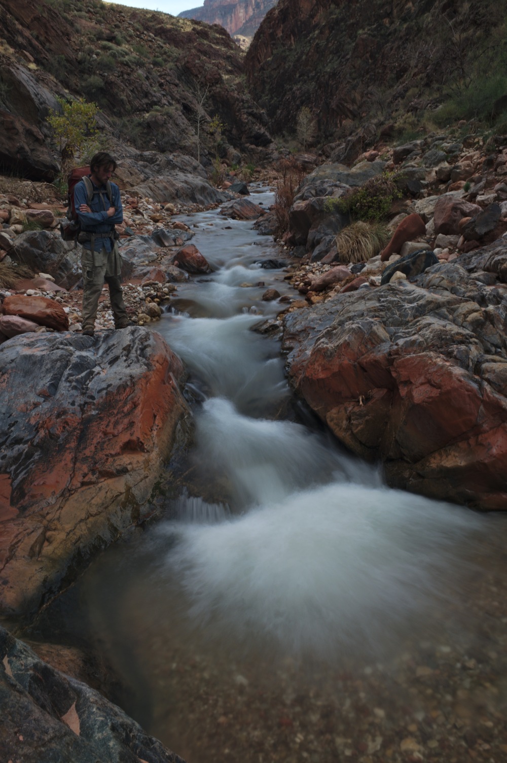
The way down Tuna Creek through the Redwall was easy, with a few pleasant bypasses.  Nothing like our climb up out of Flint.  We got down to the Tapeats in two hours, had lunch, then headed out onto the Tonto.  For the first time in the hike, the sun was shining bright, the skies were blue, and there was a pleasant breeze in the air.  I'm usually not a fan of shorts in the desert - there are too many prickly pants, and keeping the sun off of your legs often keeps you cooler.  But this time, I unzipped the legs off of my hiking pants at the first opportunity, and it just felt fantastic.  After 9 days of being confined to the same pair of pants, the feeling of freedom was incredible.  Not even the incessant drone of the helicopter tours could ruin my mood.

Blue skies and a pleasant breeze!
Craig and I have done a lot of contouring on the Tonto in the past, and it's usually a little tedious, but not bad.  This time, I had another complication, which became immediately apparent the moment I started walking the slanted slopes of Bright Angle Shale above the Tapeats.  It turns out that contouring puts a lot of pressure on the inside of the ball of your downward foot, which is exactly where my injury was.

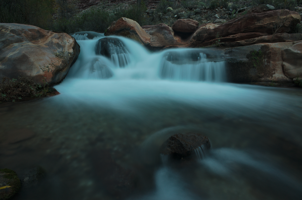
To correct this I tried not to dig into the slope with my right foot, which meant that it was sliding downward quite frequently.  Very frustrating on the steeper side slopes.  I was very glad I had trekking poles to lean on for those parts.  So after a couple hours of this, when it came time to round the point and head into the Crystal drainage, I decided to try and take the high route, heading almost up to the Muav Limestone before heading back down.  This turned out not only to be easier than contouring around below, but also faster.  We headed downhill and found the route down to Crystal that Harvey Butchart alludes to in his book.  An hour or so later we were at Crystal Rapid, back to familiar territory!  We've now been there three times, twice on the North side and once on the South side.

That night we found another solution to canyon insomnia - crashing a party.  There were four kayakers running the canyon, and they invited us to hang out by the fire.  They added the caveat that "We go to bed a little early, like 9:30 or 10".  We burst out laughing at this thought and told them that we've been falling asleep before 8pm almost every night of the trip.  We headed over to their camp after dinner, and it was great to have the warmth of a fire and other people to talk to.  They had a little homemade fire pan that was built to the exact minimum Park Service specifications.  We went to bed around 10:30 or 11 and slept straight through the night, one of the few times that happened.  19 miles to Christmas.

Kayakers scouting Crystal Rapid.
Day 11:

The next day I got an early start so that I could go easier on my foot, and Craig caught up after I was already back on the Tonto.  My foot felt a little better today, but I continued to be cautious, and also continued to follow the strategy of going high around the points and then descending back for the drainages.  And once again, it seemed faster in addition to being better for my foot.  I saw a lot of deer prints and walked on occasional deer trails, so I feel like that's a good sign - if anyone knows the most efficient off-trail route, it's probably the deer.

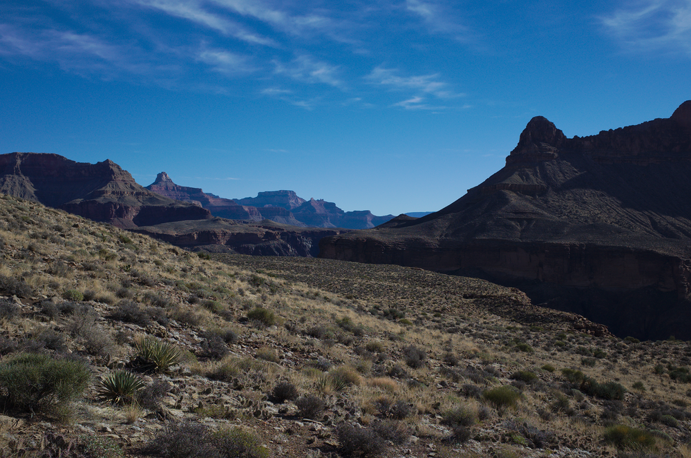
Walking the Tonto, especially this section we'd already done, puts me in a different headspace than bushwhacking through manzanita did.  Some elements are the same, but it's much less intense, and more forgiving - you don't have to keep your eyes peeled for every potential route all the time, and the worst you're likely to encounter is a patch of prickly pears.  So whereas heavy bushwhacking draws my mind out into the landscape, the Tonto pulls me inward.  It's a time for quiet and reflection.  I thought about a lot of things; life, work, planning other hikes, the possibility of grad school - it really ran the gamut.  Craig even had an imaginary 20-minute interview with Adam Sandler.

Easy walking on the Tonto.
We contoured around into 94 Mile creek, then headed down to the River.  We got there just as the last sun was about to leave the beach, and I took the opportunity to take a quick dip in the river and wash a pair of socks.  The river was silty with flow from the Little Colorado upstream.  Since it was only 3 pm, we filled up with the murky water and headed up to camp on the Tonto.

The River at 94 Mile
Tonto camps are some of our favorites in the winter.  When Arizona is under a bubble of high pressure, the weather is generally predictable: Blue skies, sunshine and calm winds.  What happens at night in these conditions is that the cold air begins to sink down from the rim, through the drainages.  Unless you're camping by the river, drainage camps tend to be freezing cold, and take forever to warm up during the day because of the late sunrise.  In contrast, when camping on the Tonto the temperature will dip briefly during the first hour or so of darkness, but then it'll actually warm up slightly as air from the river rises up and flows gently above you.  This was one of those perfect Tonto nights, one of the warmest of the trip.

I also got to run a science experiment that night - my first try at clarifying water with alum!  Alum is a "flocculating agent", meaning it makes silt particles bind together into clumps, which then settle out of the water.  It's also used to make pickles (I believe it keeps them crisp), so it's perfectly safe to add to water.  I had carried a small vial of alum for many, many Grand Canyon trips, without ever needing to use it until now.  I knew that I only needed a small amount, so I put a pinch in one of my platypus bottles, two pinches in another, and left one of my gatorade bottles untreated as a control group.  I shook the platypus bottles well to distribute the alum.

After two hours, both alum-treated bottles were significantly clearer, and the control group hadn't changed.  I'll definitely keep bringing alum on my trips in the Canyon after that - it was well worth carrying half an ounce all those miles for clear water.  10 miles to Christmas.

Day 12:

To the Ranch!  Well, today we were actually scheduled to be camped in Trinity, but that seemed unlikely; we were already a little ahead of schedule, despite my foot.  Our water had settled even more overnight, which made me wish I'd waited to treat it until the morning.  Juggling platypus bottles makes that a little tough.  If I'm ever on a trip that requires treating a lot of silty water, I'll bring some sort of collapsible bucket - maybe gallon ziplock freezer bags.

Knowing that we were so close, we got a lazy start, deliberately waiting until the sun hit us to get out of our sleeping bags.  Not starting in the cold was a nice change.  We contoured around until we could get down into the bed of Trinity Creek, then out the other side.  On this section of hiking, as we traveled East, we began to see familiar faces, one after another - the well-known temples of the main canyon, many of which I have climbed.  Isis Temple was first (no relation), followed by the crown jewel Zoroaster, Angel's Gate, and Brahma.  It was good to see my old friends showing up after so many days in unfamiliar territory.  We were now following our memories from last year's trip, when we did Steck's Phantom-Crystal Loop.

Zoroaster and Angel's Gate, visible at last
Once we'd gotten through Trinity it was just a matter of one last bit of contouring before we got up to Utah flats.  We were in the Grand Canyon Supergroup now, a set of rock layers that pops up in a few parts of the canyon.  The Hakatai Shale, one part of the Supergroup, lends itself to steep, ball-bearing hills, with a thin veneer of pebbles covering shattered bedrock.  It is extremely difficult to traverse, and I probably should've avoided it, but I managed to make it all the way across one nasty section.  Well, almost.  Two feet away from the relative stability of a boulder field, I slipped and tore a hole in my pants, and a matching hole in my shin.  Ouch.  The Canyon always gets the last word, I guess.

We made it up the climb to Utah Flats by 4:30, and decided that it was worth heading down to Phantom that night.  It looked like it might rain, and we had friends working for the fish crew that we could hang out with, with the roof of the bunkhouse over our heads.  So we headed on down and got a campsite right before dusk.  Sjores, the veteran volunteer who has lived at the Ranch for 25+ years, was the one walking around checking permits.  He looked at our battered permit, then back at our battered selves, then said "Well, you guys are in civilization now, so you're gonna have to behave a little differently".
Playing peek-a-boo with the Colorado from the top of Utah flats.
After we got set up we headed over to the trail crew bunkhouse and had a great time hanging out with the fish crew.  They were electrically shocking fish in the creek to stun them, then cataloging what they find and removing the invasive species.  The natives recover fully, a minute or so after being stunned.  One of these days I'll do a volunteer trip for the canyon.  Hanging out with the fish crew was a great time, and it was nice to fight off canyon insomnia once again and go to bed late (10 pm).  I slept straight through the night, ready to tackle the South Kaibab the next day - on Christmas!

Day 13:

Christmas morning!  After another lazy start, we headed over to the Cantina to send a couple of postcards and hang out.  Craig had a couple of beers, and a passerby had the quote of the day: "I like your style - it's noon somewhere".  We played an excellent and close game of bananagrams, then headed out on the trail.

Craig and I have a history of hiking the South Kaibab Highway.  We're always trying to speed up it and beat our personal best times.  Last winter Craig did 2:31 and I did 2:36.  A couple of months ago I got the upper hand with a time of 2:15.  I've done a ton of backpacking this year (nearly 60 nights!) and knew that I'm in the best hiking shape of my life - so getting under 2 hours seemed feasible.  I was worried about my foot, however, not to mention worn out from 12 days of hiking.  So I decided to deliberately take it easy, not push my lungs at all, and be careful with every single step that my right foot took.

The canyon left us with the same weather it had greeted us with on the start of the hike - alternating sun, rain and sleet.  As I headed up out of the inner gorge, I looked back at Phantom Ranch and saw a rainbow.  I even took a photo break (unheard of if this was a speed run!) and shot a photo of Zoroaster Temple.  But other than that, I didn't take any breaks, not even to eat - I just ate one Snickers on top of Skeleton Point, without stopping.  Thanks to the cool weather, I also only drank water 2 or 3 times during the climb, for a total of less than a cup.  In the end, I made it out with a time of 2:21.  That just goes to show how important pacing is - I was never super tired or out of breath, but I was consistent and took just one very short break.  Other than that I was constantly on the move.

Zoroaster standing proud.

Epilogue:

All I can say is, what a hike!  I've never planned a trip for this long, and never done anything so epic.  I've never been as committed or as remote as we were on this trek.  And I've never been as satisfied after a trip as this one.  It was beautiful and diverse, with wide-ranging scenery and temperatures.  It was full of water and we passed by more springs than I think the rest of my trips here have seen combined.  It was hard, but we were ready for it, and it was rewarding.

And, of course, Craig is a great friend and hiking partner - strong and reliable, with a great sense of humor.  I don't know many people I could hang out with for 13 days straight!

Craig being silly in Kanab Creek

100 Miles to Christmas - Part 3


This is the third part of a four-part trip report.  To start from the beginning, click here.

Day 8:
Personal sunrise 8:50 am
Personal sunset 4:55 pm

Camped that night atop the Tapeats, we could see that we were entering a new region of the canyon, guarded by new temples, with names like King Arthur Castle, Lancelot Point, and Excalibur.  From our camp site we couldn't see those - they were tucked deeper into the Shimuno Ampitheater, a region of the canyon bearing names from the King Arthur legend.  But we could see Holy Grail Temple, standing proudly perched atop a ridge across the creek.  I tried a star trails shot, hoping I could catch Orion rising above the temple.  Turns out I was off by a few degrees.  Guess I should carry a compass and learn to read star charts?

Holy grail is in the center, but can you spot Orion?
The next morning it was a quick walk down to where the trail hit Shimuno Creek.  Our route went up Shimuno, but we decided to drop our packs and go for a dayhike down to the river.  We followed the creek down, crossing several times, until we got to a point where it narrowed enough that we would have to wade.  We decided to turn around and head back.  We could have followed the North Bass Trail from the creek up and over a hill to the river, but to be honest, we were exhausted.  I think I had the quote of the day with "Man, I'm tired.  What could we have done to make ourselves so tired?".

In addition to our fatigue, there was a further consideration - the ball of my foot had started to hurt, and it felt internal.  Most likely a bruise or a stress fracture.  I'd had this happen before, when I was working building backcountry fences for a conservation corps.  Back then the cause was just walking too much, too fast, too aggressively, with too much weight.  Just overdoing it in general.  The solution was to stop carrying a bag of concrete into work with me every day, and be more careful about how I stepped.  In this case, the cause and solution were much the same - I dropped the bag of concrete I'd been carrying since Hack Canyon, used my trekking poles more, and started to take it a little easier.

Shimuno Creek

We returned to our packs and headed up Shimuno Creek to the confluence with Flint Creek.  Shimuno is fed by a spring far upstream in a tributary called Modred Abyss.  Much like Thunder River, an entire stream emits from a cave in the limestone.  I've never been there, but I'll have to come back when the weather is warmer and make the trip up there - I hear it's quite wet getting up to the cave.

Are you tired of long-exposure water shots?  So is Craig!
This was our last big creek of the trip, but even Flint Creek had a trickle as we headed up it.  We speculated as to its origins (a spring, or snowmelt from the rim?), but it was clear and tasted fine.  We walked until the sun was about to set, then found a really nice campsite right on top of the Tapeats, by the river.  It was kind of like a Tapeats castle, with two other castles across the river.  A fitting campsite for the land of King Arthur place names.  30 miles to Christmas.

Day 9:
Personal sunrise 10:34 am
Personal sunset 4:55 pm

Today we were to tackle one of the big unknowns of the trip - how to get through the Redwall in Flint Creek?  For those unfamiliar with the Canyon, the Redwall is notorious for being one of the most difficult layers to find your way through.  In most of the canyon, it forms an impenetrable barrier of cliffs, and breaks in those cliffs are few and far between.  George Steck had this to say about getting through the Redwall in Flint:

It is tempting to try to continue up Flint to the saddle, and I have done so, but getting out involves so much brush and complicated bypasses, that I think the way I will describe is easier. After you leave the Flint drainage, climb up along a ridge and through some small Muav cliffs to the base of the Redwall. The upper wall meets the lower at the far right hand side of the bay, where a scary 30-foot climb takes you to the bottom of the bay.

We were turned away from the scary climbs (well, they sounded like fun to me; Craig has a different exposure tolerance).  So we decided to try going up Flint, with its unknown number of complicated bypasses, and unknown brush.  But hey, we just walked two days through manzanita; how bad could it be?

We headed up Flint and quickly encountered cottonwoods.  Some were standing, but many had fallen and we had to climb over (or under) them.  But still, not bad for brush.  Then the cottonwoods cleared out and the creek turned into a little slot with waterfalls in the Muav Limestone.  It was a really pretty section and there's no need to bypass it if you're willing to do a bit of fun and easy climbing.

Easy scrambling up a series of little waterfalls in the Muav
Shortly thereafter, we hit the Redwall and just around the corner was our first pouroff, a huge one of about 50 feet in height.  There was a bypass, we knew, but where?  We pondered several ledge systems, scrambling around to get a good view, and each one turned out to have a short impassible section.  Then we spotted a ledge higher up that seemed plenty wide, and went around the corner above the pour-off and out of sight.  Would it go?  It better, or we were heading back to try Steck's scary 30-footer.

The redwall pouroff.  Our ledge is the one in the upper right.  Not the one that looks like it could lead down to the top of the pouroff, but the one that leads around the corner and out of sight.
We hoisted our packs and headed up to the ledge, passing three short sections of climbing before gaining it.  They were each 3rd class, with the first being the hardest (I opted to haul my pack with our handline rather than climb with it).  Now that we were on our ledge, the only question was how far it would lead.  It immediately started out with a spicy, skinny section, but quickly widened.  We walked around the corner, into the unknown.

On our ledge!  Not the "spicy, skinny section".
Our luck held, and the ledge continued on up the canyon.  We could see a potential route back down to the canyon bottom, too.  But we could also see that we might be able to get out and all the way above the Redwall, where we could join Steck's preferred route and contour over in the Supai.  So we kept on our ledge, hoping for a way up.  It stayed comfortably wide, but with great views.  It could've easily pinched out and left us to retrace our steps back to the canyon floor, but it didn't.  Our sidewalk in the sky just had one more narrow section, and then it turned into a drainage that we could easily climb.

Our sidewalk through the sky.
After that the routefinding was easy and straightforward, with one section of 3rd class choss near the top of the Redwall.  I was most of the way up it when Craig asked "Nick, am I good to start climbing?".  I thought about it, said "maybe wait a couple seconds", and without warning the rock beneath my right foot gave way.  Several very large rocks came crashing down at high speed, whizzing through the air next to Craig (who was protected just around the corner).  Scary.  I finished my climb, gave Craig the ok, and we were on top of the Redwall!

Despite the scary ending, this was my favorite Redwall break that I've done in the canyon.  There were no cairns, no footprints, no signs of human passage at all.  Just us finding our way through to the best of our ability.  I also love airy routes, and this was certainly that - walking a ledge with a cliff above and a cliff below, without knowing if the ledge would continue for us, was awesome.  And the fact that the route we found was probably better than either of Steck's, and as far as we know unpublished until now, made it even cooler.

Easy going the rest of the way to the saddle.
Once atop the Redwall, it didn't take long to contour along and get to the Flint/Tuna Saddle.  We dropped our packs and headed off on another mission - to retrieve the second cache.  When I hiked down in October, I ran out of time and had to leave the cache at the base of the Coconino, so we had a walk of nearly an hour to get there.  Oh, well.  It was a nice hike, and beers on top of the saddle tasted wonderful.  We set the tent up with the door rigged open, to act as a windblock.

My mid set up as a windblock.  I love this tent, it's very versatile.  Also, Craig is modeling the insulated balaclava that I made just before this trip.
This was the last of our scenic divides; from here, it would be one long day down to Crystal Rapid, and from there we would travel mostly on the Tonto platform over to Phantom Ranch.  Craig and I had done that section in the past, so we were nearly done with all the unknown.  Just one more break in the Redwall down to Tuna awaited us.  26 miles to Christmas!

To read the fourth and final part of the trip report, click here.

Saturday, December 27, 2014

100 Miles to Christmas - Part 2


This is the second part of a four-part trip report.  To start at the beginning, click here.

Day 4:
Personal Sunrise 7:59 am
Personal Sunset unknown (cloudy)

Today was an exciting day - a time to redeem our long term planning.  I'm speaking, of course, of collecting one of my food caches.  We hit the Thunder River trail, dropped our packs and headed up to the rim.  My cache hadn't been disturbed, other than a hole chewed through my note by a mouse.  Most importantly, the beers were still intact!  We walked back down the trail, and I had no pack and a beer in my hand.  This was the only moment during the hike that I really wanted to meet another backpacker out there, just to see the reaction.

Good thing the mouse read my note and left my food intact!  Or maybe he chewed through it out of frustration after being thwarted by the paint cans?

We returned to our packs and continued along the Esplanade, this time on the Thunder River trail.  Having a trail made the walking a lot easier; especially avoiding the Cryptobiotic soil that is so prevalent in this part of the Canyon.  Beautiful stuff.

This part of the Canyon is full of beautiful, delicate Cryptobiotic soil.

We made it to the edge of the Esplanade platform and started down the trail to Surprise Valley.  Surprise Valley was formed when a huge block of rock slide down into the Colorado River, turning as it went.  From the junction in the valley we turned left to head towards Thunder River, our site for the night.  I had never been there before, and I'm glad we got to include it in our route.  From the middle of a cliff (in the Muav Limestone), the water comes pouring out of the rock to form a waterfall, which cascades down the slopes below.  Absolutely beautiful.  It also has the dubious distinction of being a River which flows into a Creek, which flows into another River, which does not reach the Ocean.

Thunder River.
We camped at the Upper Tapeats Camp, just below the confluence of Thunder River and Tapeats Creek.  As impressive as the river is, it's not even the main source of the creek - Tapeats Cave, farther upstream, supplies an even stronger fountain of spring water.  The combined flow lulled us to sleep that night, until we were woken up by rain and had to bail into the tent.  57 miles to Christmas.

Tapeats Creek
Day 5:
Personal sunrise 2:06 pm
Personal sunset 4:20 pm

After a full night of rain, during which rats tunneled through Snickers bars in Craig's pack, we had a decision to make - continue up our original route, up Tapeats Creek and Saddle Canyon?  Bypass Tapeats above the Tonto but still do Saddle?  Or do the true backup plan, hike back up to the Esplanade and contour above the Supai around to Muav Saddle?  The first plan would go, but guarantee us getting soaked in the narrows of Tapeats Creek.  The second plan avoided that section, but Saddle Canyon would definitely still have some wading.  And the third definitely was possible, but we had no beta on it and were pretty sure it would involve some tough bushwacking.

We figured that we were well equipped to deal with snow, rain, or any other form of precipitation we were likely to deal with.  We also had an extra day's worth of food in case the route proved more difficult than anticipated.  And we are both very experienced with bushwacking.  Given the recent rain and the fact that every pool in Saddle Canyon was surely full to the brim, we decided to go for option 3 and head back up to the Esplanade that night.  First, however, we decided to take a side trip to Deer Creek.

The beginning of the Deer Creek narrows
Deer Creek is another stunning jewel of the desert, a gorgeous spring-fed slot canyon.  The trail takes you from Surprise Valley, past one of the sources of the creek, and then down creek to where the slot begins.  Once the canyon bottom drops away, the trail follows ledges in the upper part of the slot.

Careful . . .
After Deer Creek we headed back up above Surprise Valley to the top of the Supai to camp for the night.  At first, it looked like it was going to clear up for the night, and I was able to get one milky way shot in, but then the clouds moved in.  Which isn't always a bad thing after a rainy day, since cloud cover keeps the nights from being too cold.  The next night we wouldn't be so lucky.  53 miles to Christmas.


Day 6:
Personal sunrise 2:06 pm (again!)
Personal sunset 5:08 pm

Snow, sleet and sun alternated all day.  We were contouring on the Esplanade, but the sandstone quickly petered out and was replaced with bushwacking, of increasing intensity.  We were leaving the wide sandstone expanses of the western Grand Canyon and heading towards the land of heinous bushwacks - high drainages on the North Rim drainages.  The elevation of the Esplanade increased as we were heading up the Kaibab Upwarp, and the microclimate began to shift towards a wetter one that favored such plants as manzanita, scrub oak and cliff rose.  They are beautiful plants, and I'm particularly fond of manzanita.  But the abrupt shift from easy sandstone walking was a rough one.  We tried to take the path of least resistance, but by the end of the day our shoes were soaked from the snow and our shins were battered from pushing aside manzanita branches.  Craig even had a pocket ripped open and his knit hat ripped out.  For the rest of the trip, he would borrow either my fleece hat or my balaclava, whichever I wasn't using at the time.

A rare moment of easy walking.
Fighting our way through the brush, we headed the tributaries of the Tapeats Cave drainage, then headed down into Crazy Jug Canyon and out a tributary on the other side.  By the end of the day, we had our bushwhacking heads back on and were finding better paths through the brush, but it was still tough going.  The drainage crossings were the worst, filled with oaks and snow in the bottom and on the north-facing sides.  Our goal was to cross Timp Canyon and camp on the other side, to hopefully ensure that we would make it past Muav Saddle and down to lower elevations on our next night.  By the time we got to Timp it was after 4 pm, but the sun had come out and Timp turned out to be one
 of the easier drainages to cross, so we made it with time to enjoy the sun setting behind Mt. Trumbull.

The sun setting across Timp Canyon.

As we ate dinner, we noticed that the clouds had cleared up all over the sky.  It looked like a front might be moving in, clearing them away.  Good news for tomorrow, but bad news for tonight.  Without a thermal blanket above us, the earth radiated away its energy quickly, and the cold set in.  The clearest sign of this came from my sleeping bag, which had gotten slightly damp during the day.  While I was still eating dinner, a little before 6pm, that water was turning to frost!  We quickly moved every damp or loose item under or inside of a pack, "to prevent frosting".  Too bad we didn't have a cake.  44 miles to Christmas.

Day 7:
Personal sunrise 8:35 am
Personal sunset 3:18 pm


Sunrise from my sleeping bag

What a long day.  8 miles as the crow flies, much longer by our route.  We woke up to beautiful blue skies, a gorgeous sunrise, fog in the distance below Mt. Trumbull, and shoes frozen solid.  Thankfully the shoes thawed rather quickly once we started walking.  We had three major drainages to cross.  Stina Canyon was the biggest, and we contoured into it on a nice patch of Esplanade to plan our attack.  By now we had gotten better at this and were able to find a way down, a nearly brush-free crossing right above a pour-off, and then a scramble up the other side.  A little foresight goes a long way when you're battling oaks.

Sunrise a few minutes later

We continued up to Muav Saddle on the eastern slopes above Saddle Canyon.  The drainage crossings were full of scrub oak and the occasional new mexican locust, but most of the hiking was in juniper/manzanita country, with the occasional pinyon, agave or prickly pear.  I really enjoy this kind of bushwhacking - enough challenge to keep it interesting, but not enough to get frustrating.  And after the day before I was fully in the zone and prepared for it.  It puts one in a unique headspace; mind occupied simultaneously by your route on multiple scales.  You need to pay attention to your immediate steps: avoiding that prickly pair, for instance.  And you need to look ahead for paths of least resistance through the vegetation, connecting them to each other and forming hypothesis about what might lay ahead.  Finally, you have to make sure you're meeting your general goals of where you want to get to - contouring and maintaining elevation, heading up to a saddle, entering or leaving a drainage, etc.  With my mind occupied by all of these things, I feel fully present in the landscape. 

Manzanita.  'nough said.

As we ascended through the brush, we kept thinking we would drop into Saddle Canyon, but the slopes on the east side kept presenting us with better alternatives.  The junipers gradually gave way and we were walking through knee to waist high manzanita.  The day before this would have frustrated me, but with the right head on my shoulders I just slowed down slightly, gave the branches their due respect, and passed through the gauntlet relatively unscathed.  Working with and around the manzanita, rather than against it, makes a huge difference.  And it sure as hell beats fighting locusts up a drainage.

Finally, however, the good manzanita ran out and we dropped into Saddle Canyon just after Powell Spring.  The drainage was easier than we expected, with the occasional oak or locust to avoid, but no thickets.  And best of all, we were entering ponderosa pine country.  These were big, old-growth ponderosas, most of them at least 3 feet wide.  These old trees have a yellow-red bark and are called "yellow-bellies".  They also have an amazing smell to them, like butterscotch or vanilla.  I made sure to stop and put my nose in between the bark of the bigger ones.

Heading up the Saddle Canyon drainage in the snow

Up on Powell Plateau, just a short walk from Muav Saddle, lies an even larger grove of yellow-bellies.  Protected from logging by the relative difficulty of accessing them, they remained unscathed.  Up there, every tree is a yellow-belly, and when you top out on the plateau the entire place smells of butterscotch.  If there had been less snow on the ground we would've made the side trip up there, but we wanted to ensure that we camped down lower to have a warm night.

We got to the patrol cabin below Muav Saddle at 2pm.  This was used by Teddy Roosevelt back when he was hunting cougars on the Plateau, and now is used occasionally by backcountry rangers.  It contains a register, and as is my way when I encounter a register, I added a haiku:

Snow makes great TP
Forty miles to Christmas
There's beer at the Ranch

The PEAKS!

After reading and writing in the register, we headed up to the Saddle, and I could see the San Francisco Peaks!  It was great seeing a little slice of home.  This was the mental crux of our trek, and we had been dreading the snow for the previous couple of days.  It was also the halfway point, in terms of time.  So it was great to be over the hump and headed down.  This was our second scenic divide - we said our goodbyes to the Esplanade for good, and headed down the North Bass Trail.  Having a trail made a huge difference in our time, and we got all the way below the Redwall and out onto a campsite on the Tapeats sandstone before dark.  Craig had the quote of the day on the way down: "It's nice to be walking through the manzanita, without walking through the manzanita".

34 miles to Christmas!

To read Part 3 of the story, click here.

100 miles to Christmas - Part 1

From December 13th to December 25th, 2014, my friend Craig and I embarked on the most epic backpacking trip that either of us has done.  100 miles across the Grand Canyon, starting at Hack Canyon in the West and with the goal of reaching Phantom Ranch by Christmas.


The route involves only about 20 miles of official trail between Hack and the Ranch, not counting the South Kaibab at the end.  Most of the rest involved easy route finding, following creeks or contouring on terraces.  There were a couple of sections that were relatively unknown, but we both knew that they would "go" - how easily was another question.

We planned it for nearly a full year, and in October I drove to the North Rim, got the permit, and hiked two food caches in - one off of Point Sublime, and one near the Indian Hollow Trailhead.  In order to ensure that we didn't feed any wildlife we used some very sturdy containers (paint cans for one and an ammo can for the other), so I'll have to make another trip back up there to retrieve the two caches.

The trip went great, despite some bad weather - we even made it to Phantom a day early and hiked out Christmas morning.  We had three major "scenic divides" on the trip, where we crossed over a pass and the landscape changed dramatically.  One at Fishtail Mesa saddle, one at Muav Saddle, and another at the Flint/Tuna Saddle.  I've divided the trip report into sections based on those divides.  This first installment covers from Hack Canyon to Fishtail Mesa Saddle:


We did not carry a GPS, so the track above is an estimate drawn on Caltopo, after the hike.  You could probably add 10-20% to all of our distances to get how far we actually walked.  Among other things, we kept track of "personal sunrise and sunset" - defined by the first and last moment in the day when the sun shines brightly enough for you to cast a distinct shadow.

Day 1:

We were treated to a gorgeous show of light at the South Rim on our drive up.
Our day started by meeting our shuttle driver - my Dad.  We got in our cars and drove to the South Rim, leaving Craig's van at the visitor center, for us to drive back to Flagstaff at the end of the hike.  We got into my Dad's Civic and headed off.  As we drove along the rim road, the canyon treated us with a beautiful show of light, shadow, and snow.  Wonderful to behold, but also ominous for our shuttle - the plan being to drive the Civic as far down Hack Canyon road as it could reasonably go and then hike from there.  We took a brief pause at Moran Point for photos, then got back in and headed off to the uncertainty of Mt. Trumbell Road.

Ominous skies as we turned onto Hack Canyon Road
The road was in good shape, with just a few puddles, and we got to Hack Canyon road without incident.  Again, this storm system gave us a show of dramatic clouds and light. Beautiful and ominous. Hack Canyon Road required us to get out several times and walk along, moving rocks to accommodate the astoundingly low clearance Civic.  But we made it down to the Hack Canyon Mine and said our goodbyes.

Thanks, Dad!
I've never felt as committed to something as that moment, watching my Dad drive out of view, then turning East and imagining the path before us.  I had been to two places on the route between here and Crystal Rapid.  That was 10 days away.  Everything else was new territory for me.  We had all the information we needed, and we new the route would go, but it still felt like it was going to be quite an adventure.

Nothing says commitment like getting dropped off with our packs on a rainy day with no cell service and no vehicle.
We walked through intermittant squalls and sunshine down the Hack Canyon Road and then Trail, passing ephemeral waterfalls when we reached the Supai.  We found a great overhang camp and managed to avoid setting up our tent.  We made simultaneous bets, Price is Right rules, on how many nights we would use the tent.  I guessed 2 and Craig guessed 1.  93 Miles to Christmas.


Day 2:
Personal Sunrise 9:20 am
Personal Sunset 5:05 pm

Kanab Creek - a gentle, flowing stream through the redwall.

This was a long day.  Possibly the most miles either of us has ever walked on a single day of backpacking.  We continued on down Hack Canyon, descending through the Supai.  Out here in the Western Grand Canyon, the top layer of the Supai Group, the Esplanade sandstone, forms large, flat terraces.  This makes it feel a lot like the Needles district at Canyonlands, and Hack had the same feel.  We hit Kanab Creek and turned right.  From here it's 10.5 miles to the confluence with Jumpup Canyon, and we made it in about 3 hours.  Easy, flat walking.  As Kanab descended into the Redwall, it got more and more beautiful.  It's really quite unique in the Grand Canyon - a gentle creek bubbling its way through the grassy bottom of a canyon with towering, straight walls.

Easy walking up Jumpup canyon.

The grass ended when we started up Jumpup, but the walking remained easy.  Our packs were heavy with a week's worth of food, but rainpools were frequent and we weren't carrying much water, so we cruised up to the top of the Redwall and headed into Kwagunt Hollow.  Kwagunt was a way to avoid Steck's "Obstacle Pool" in Indian Hollow - a pool that was certainly full to the brim.  And on the plus side, Kwagunt is a spring-fed canyon in the Supai.  Quite beautiful.  Nearing the last layers of Supai at 4:30, we realized that we could potentially make the Esplanade tonight, and have beautiful views and an earlier sunrise.  So we got a second wind and raced against the clock to arrive on top of the Esplanade right as the sun set.

Just in the nick of time.

Craig and I have done quite a few hikes in the Canyon in the winter, and there's a phenomenon we call Canyon Insomnia.  First, you get to camp and immediately change into every warm layer you have.  The desert loses heat quickly in the winter.  Then you're so tired after dinner that you fall asleep before 8.  But the nights are so long that it's hard to sleep through them, no matter how tired you are.  And it's also pretty much impossible to eat enough at 7pm to last you until the morning.  So my routine is to wake up around midnight, warm a Snickers bar in my sleeping bag, then eat it while I read on my Nook or watch the stars.


This night, however, I had a new method of keeping myself busy - night photography.  I stayed up until about 11pm shooting milky way shots, watching the tail end of the Geminid Meteor Shower, and setting up for a star trails shot.  With the camera set up on my Trailpix tripod, I went to bed and let it kill a battery getting the trails.  I slept straight through the night to the next morning, so I called that a success - unfortunately, this was the only night on the trip with clear skies and a good composition to do much night shooting.  Oh, well.

77 miles to Christmas . . .


Day 3:
Personal sunrise 8:55 am
Personal sunset 5:13 pm


The next morning treated us with a gorgeous sunrise.  Blue skies and full rain pockets cheered our spirits as we traversed the Esplanade towards Fishtail Mesa, doing our best to avoid stepping on Cryptobiotic soil (quite a bit harder to avoid on an off-trail route).  Once again, the whole landscape felt like we were in the Needles, and the full rain pockets just added to the magic.  Rain pocket water is wonderful - unlike rainpools that are in a drainage, the catchment area for an Esplanade pocket is rarely much bigger than the pocket itself.  So, with very little danger of water-borne illness, we filled up frequently, never bothering to treat the water or needing to carry more than a liter at a time.  Sometimes we would just lean down and sip straight out of the pool.

Tributaries of Indian Hollow.
    
Finally we rounded the tributaries of Kwagunt and Indian Hollow and got into the Indian Hollow drainage itself, just at the top of the Supai.  Indian Hollow heads up to the rim (and to our first cache), but we avoided some scrambling and snow by heading up and over the saddle connecting Fishtail Mesa to the mainland.  The north slope was strenuous but straightforward, and we got to the saddle pretty quickly.  From here, we could see back to Hack Canyon, and ahead to Powell Plateau and Muav Saddle, ominously covered in snow.  We found the descent route down, which was a steep Coconino talus slope.  Back on the sandstone, we contoured until the sun was low, stopping at some water pockets to set up a camp.


At camp we got our first food cache - a giant sized Snickers bar that we special ordered from Mars.  It comes complete with a hard, mouse-resilient exterior and would feed us for the next four days.

Well that's a big Snickers!
This was the first of three major scenic divides on the trip - we said goodbye to the Kanab Creek drainage, Jumpup, Indian Hollow and Kwagunt.  Soon we would say goodbye to the Esplanade altogether, and start making our way over to Muav Saddle.

68 miles to Christmas...

To read Part 2 of the trip report, click here.