 |
| The whole enchilada. Yellow dots are campsites. |
Time for another trip report! This one was from South Canyon to Nankoweap. I'll be posting it in three parts - one for the Marble Canyon section, one for the Butte Fault route, and one for the rest of the trip. Above this is a map of the entire trip we took, and below is a map of the section described in this post. Read below for the detailed description and photos.
Note: I make use of my "chili pepper" scale of spiciness for exposed routes in this trip report. In short:
- 1 chili pepper: My cousin Pam could do it (i.e. not exposed at all)
- 2 chili peppers: Craig can handle it with ease (exposure or tricky climbing, usually not both together)
- 3 chili peppers: I can handle it, no problem. Scrambling with exposure. Usually this is 3rd class but sometimes 4th.
- 4 chili peppers: I can handle it but I'm in "free solo" mode, which means never taking two limbs off the rock at once, assuming that every hold will break off, and being extremely focused the whole time
- 5 chili peppers: No way, Jose.
 |
| Part one of the hike (Marble Canyon section) |
Day 0: 0.7 miles
Squeeeel screeech . . . screeeech . . . screeech . . . scrape . . .
- Nick's Subaru
Last year my friend Craig and I embarked on a landmark hike for us, 100 miles across the Grand Canyon, with most of it off-trail. That hike started as an isolated adventure, conceived one afternoon in the Grand Canyon Backcountry Office while looking at Harvey Butchart's map of routes in the canyon, and realizing how we could connect many of his lines into one hike. But in the months afterward, it turned into a plan to hike the entire north side of the river in sections, from Lee's Ferry to Pierce Ferry. There would be 6 total. With the first one down we set our sights on the section from Nankoweap to Phantom Ranch for our second trip. This would meet up with our previous trip and mirror it, coming in from the other side. (To read last year's trip report, click here)
Anyway, back to the present. With my Subaru in questionable condition, we were unwilling to take it out to the remote Nankoweap trailhead. So we decided to switch vehicles, to my Dad's Civic hybrid (our shuttle vehicle from the year before). It had handled Hack Canyon remarkably well on the last hike, but we felt it lacked the clearance to make it to the end of the Nankoweap road. The solution was clear - grab a couple more days' of food and start at South Canyon instead.
The decision to start at South would add 3 days to our trip, and they were some pretty hard ones - but we didn't know that last part just yet. We packed our bags again, drove up to the South Rim and got the permit, and then headed off to the trailhead. The road out to South Canyon was in great shape and we only bottomed out twice on our way out there. We stopped a short distance from the actual trailhead, when the road got rocky. My Dad dropped us off, wished us luck, and headed on down the road.
 |
| See you later, Dad! |
 |
| Few things feel more committing than getting dropped off at the end of a desert road, carrying everything you need for two weeks of travel on your backs. |
Day 1: 11.7 miles
A one, a one, a one two three nope!
- Craig, trying unsuccessfully to get out of his sleeping bag on our first cold morning
 |
| A cold snap hit northern AZ just before our hike. In South Canyon, evidence remained. |
 |
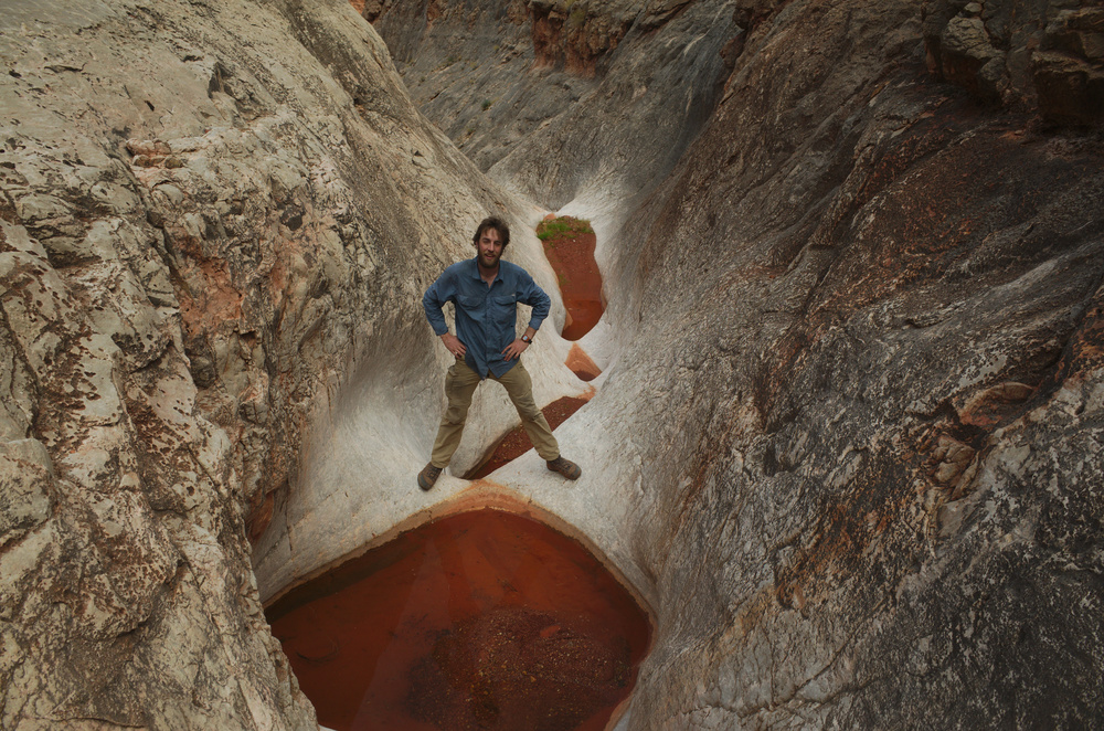
| Part of the route down into South Canyon. Spot the wildlife |
We filled up with what we thought was just enough water to make it to the 50 mile route (our next route to the river), albeit very dehydrated. This is a common strategy for us - fill up with the bare minimum and hope to find more for comfort. (Note: this is a safe strategy for experienced hikers in the winter - not so safe in the summer. Hike smart and know your abilities). We figured we'd be at Nankoweep in a couple of days if we hiked fast, so we packed a few liters of water each out of South Canyon.
 |
| Walked over a natural bridge. Because, why not? |

Day 2: 10 miles
I hate that phrase 'contouring around'. It makes it sound so easy, when it is often so hard.
-George Steck, Grand Canyon Loop Hikes
Of course, it usually doesn't turn out that way . . . and this time was no exception. When we woke up this morning, I knew I was sick. Sick with what could become a simple cold, or a case of the flu. There was no sense in dwelling on it, but it certainly had the chance to make me miserable. Two years before I'd hiked from South Bass to Boucher on the Tonto and on the 2nd day I'd come down with the H1N1 virus (AKA the swine flu). It lasted the entire 8-day trip and a few days after, and it was some of the most miserable hiking I'd ever done. And that trip was on a trail!
I knew now that we would hike slower than expected, and also that I was going to want to drink a lot more water. So I was happy when we came across water in a couple of minor drainages early on in the day. We felt pretty confident after that that we would find water in lots of drainages coming from the rim. Even if some of those potholes were below accessible pouroffs, we could still get water in the other ones.
 |
| Water pockets we found in a minor drainage. |
With our water issues more or less settled, we set about the task of getting some miles under our feet. Easier said than done. At times, we had easy contouring to contend with, but overall the Redwall contouring was among the toughest walking I've done anywhere.
There's no easy answer as to why. The Tonto platform has many of the same challenges (boulder fields and washes to cross, cliffs to avoid and big drainages to head). So we knew what to expect at a basic level. I think the Redwall section just has fewer flat sections and more obstacles to contend with. This is partly due to the nature of the Redwall and also to the friable nature of the Supai, which contributed most of the blocks that we had to climb over in those boulder fields. On the Tonto you can get long sections without crossing any major drainages or scrambling over boulder fields. On the Redwall, it seems like you never get a break.
 |
| The Redwall doesn't offer as expansive of a plateau to contour on as the Tonto does. But sometimes you get nice deer trails, right on the edge! |
On the way we encountered the old Marble Dam site. Back in the 1950's, surveys were carried out here for the proposed dam. At the time this was outside of Grand Canyon National Park. There were also proposals to direct most of the river's water through a tunnel all the way over to the Kanab Creek area in order to generate hydroelectric power without building a dam in the park itself! Thankfully both of these plans were scrapped and Marble Canyon was added to the National Park in 1975. Some trash still remains from the exploratory drilling surveys, however.
 |
| Some trash left by the dam surveyors. |
We continued on to 36.7 mile canyon, where we had heard of a large pothole from Butchart's book. We had found other water so we didn't need it, but we were curious to find it. When we got there the pothole was below a large chockstone and dryfall. Climbing down looked pretty tough (I'd rate it 4.5 chili peppers on my 5-pepper scale, which means I'd do it if I had to but I'd try very hard to avoid it). We pondered a scheme of lowering a water bottle on a string, which I think would have worked, but we didn't need the water so we saved ourselves the effort.
It was on this section that we thought up a scheme for getting water on this route. I have some 3mm spectra guyline which has a pretty high breaking strength. So if you brought several hundred feet of it, along with a small waterproof bag, you could put a rock in the bag, throw it into the river from above the Redwall, and drag up drinkable water. You could even put "Please Fill With Beer" on the side and you could throw it in front of river parties. The whole setup would weigh a couple of pounds and would work in a few places along the route. That said, I'd much rather just go in winter after a storm, when you can find water in potholes. But the scheme would be a lot of fun to try.
 |
| Water in the last canyon before Buck Farm. There was an easy tunnel route (2 chili peppers) under this chockstone to reach the potholes below. |
When we got to camp, we took a look at a shortcut we had been eyeing on our topo map. Point Hansbrough extends for a couple of miles out into the canyon, and rather than walking several miles around it, we could head for a saddle where the top cliff band of Supai breaks down. Or at least that's what it looked like on the map. When we got there and took a good look, we could see a probable route up through the lower Supai cliffs. We had no idea if we could get down the other side, but in the Supai you can usually find a way, so we felt pretty confident about the next day.
 |
| Sometimes the Redwall walking is easy . . . |
 |
| And sometimes you come to a side drainage and it looks like this. |
Day 3: 10.2 miles
I think I'll contour just below the really big potatoes, above the baby reds. - Craig
Stop reminding me that I forgot the butter! - Nick
 |
| Climbing the second Supai band, heading up to the Point Hansbrough saddle. |
 |
| The Point Hansbrough saddle. |
The rest of the day followed the same pattern as the one before. It was becoming familiar - I would wake up with a lot of energy from a restful night of sleep, and walk fairly quickly for the first half of the day. Then in the afternoon my illness and tiredness would catch up to me and I'd slow down quite a bit. So as we neared Saddle Canyon I was starting to get pretty tired. Fortunately Craig was paying attention to the map and noticed that the point above the mouth of Saddle on the upstream side would likely have a really good view both up and down the river, so we focused on that as our goal for a late lunch break.
 |
| Some rare easy walking on the way to Saddle Canyon. |
 |
| Probably the best wildlife shot I've gotten in the canyon. |
 |
| The pano I shot above the mouth of Saddle. One of these days I'll come back and get a better shot... |
 |
| Just past Saddle Canyon. |
We set up the tent and I got into my sleeping bag before 5 pm. I was still feeling sick and very worn out. We had finally passed what was to be our original entry into the Canyon - the route down off of the rim in the drainage north of 50 mile. It only took 3 hard days to get there.
Day 4: 9.5 miles
Do not release outdoors
- Writing on a scrap of a helium balloon, found above the Little Nankoweap route
Finally, we were going to make it to Nankoweap! I was feeling worse every day, so we decided to make this a low-mileage day and camp at Nankoweap creek. Turned into a few more miles than we thought, but it still felt relatively easy. We could see a bit of trail heading out of 50 mile, but from our campsite we decided it would be more efficient to head up a talus slope to the top of the Supai and then find a way down somewhere on the other side.
The going was easy enough, and soon we were on top of the Supai. We could see a route down, but we'd have to backtrack a bit to descend, then contour over a few drainages and some boulder fields we could see below us. I convinced Craig that we should just contour on top of the Supai until the Little Nankoweap drainage and then find a way down. It looked so easy from where we were standing.
Of course, when we got around the next corner we realized that we'd have some drainages to cross up there as well. I'm still not sure which route would've been faster, but we got to the point before Little Nankoweap soon enough and found a way down right off of the point. The views down to the mouth of Nankoweap Creek were incredible. Soon we were on the river runner's trail that heads down the Little Nankoweap redwall route.
The Little Nankoweap route is steep and exposed, including two spots where we passed packs. It's a solid 3+ chili pepper route. But the route is well-used, so it's cairned and easy to find. Soon we were at the bottom and it was a short walk down to the river. Craig went off to see the granaries and I laid out in the sun to rest (I'd seen the granaries twice before). The sun was shining and the temperature was mild, but I needed every one of my layers on to feel warm. I'm pretty sure I had a fever at that point. Craig returned and we hiked up creek to a campsite near where the Nankoweap trail hits the creek and set up camp early, around 4 pm.
We were exhausted, but excited to move on from the Marble Canyon section of our journey, into new territory. We knew that the Butte Fault route wasn't a walk in the park, and I wasn't getting better any time soon. But at least we wouldn't have to contour for a while.
To read the next chapter of the trip report, click here.
The going was easy enough, and soon we were on top of the Supai. We could see a route down, but we'd have to backtrack a bit to descend, then contour over a few drainages and some boulder fields we could see below us. I convinced Craig that we should just contour on top of the Supai until the Little Nankoweap drainage and then find a way down. It looked so easy from where we were standing.
 |
| View from above the Supai near Little Nankoweap |
 |
| The beginning of the descent into Little Nankoweap |
 |
| Craig took this shot of Mount Hayden standing tall while I was resting in my sleeping bag. |
To read the next chapter of the trip report, click here.
2 comments:
Pretty awesome pictures. Nice route
great pix. love the sunsets. looks like quite a few dicey traverses. congrats to your first 100m.
Post a Comment